If you look at the sea, it appears to be an expanse without borders or limits, where everybody could roam boundlessly. But then, if you think about all the activities taking place there (fishing, transport, fish farming, tourism etc.), you realise that they each occupy a bit of that expanse, and that there are plenty of activities taking place at the same time, with the risk of some disrupting the others. For those activities to coexist there is a process, called maritime spatial planning (MSP), which analyses and plans the distribution of human activities in marine areas to achieve ecological, economic and social objectives. Its goal is to develop spatial plans, which define the effective use of marine areas for different maritime activities and sustainable use of marine and coastal resources. At the same time, MSP creates a framework for coordinated, transparent and sustainable decision making on the basis of reliable data and cooperation across borders.
Now, focus on the Black Sea. That sea is the EU’s eastern gate, a junction between Europe, Central Asia and the Middle East, an important transport and energy hub, a crossroad of different cultures, a region with significant political, social and economic fragmentation. The Black Sea is among the most endangered ones in Europe, with a “closed” and unique ecosystem under threat by the continental pressures and conflicting coastal and maritime activities.
Now, focus on the Black Sea. That sea is the EU’s eastern gate, a junction between Europe, Central Asia and the Middle East, an important transport and energy hub, a crossroad of different cultures, a region with significant political, social and economic fragmentation. The Black Sea is among the most endangered ones in Europe, with a “closed” and unique ecosystem under threat by the continental pressures and conflicting coastal and maritime activities.
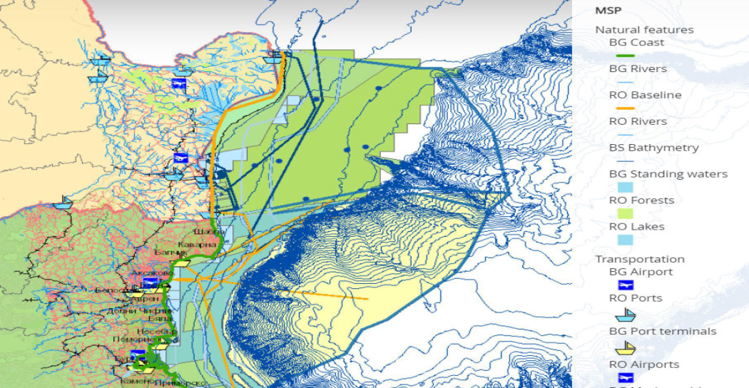
This is where the MARSPLAN-BS II project comes into play. Building on a previous project, which ended in early 2018, MARSPLAN-BS II will last into 2021 to further develop maritime spatial plans and a common cross-border strategy between Romania and Bulgaria for the Mangalia-Shabla area. This area presents a high level of complexity in terms of important maritime ports and shipyards, touristic resorts, biodiversity and wetland protected areas and mineral resources (gas extraction).
The main aim is to support coherent maritime spatial planning (MSP) focusing on social, economic and environmental objectives and establishing a stable framework by Bulgarian and Romanian authorities. The project is analysing the current and future uses and conditions of the cross border area and developing draft MSPs for both countries. The process involves consultation of all relevant stakeholders, authorities and the wider public, involving also non-EU countries in the Black Sea (eg. Ukraine, Turkey and Georgia). The resulting plan will be approved, implemented and monitored.
EU support has significantly facilitated the creation of a MSP. This helps protecting the environment of the Bulgarian/Romanian cross-border area of the Black Sea, as well as ensuring a sustainable use of the sea, in turn boosting the sustainable growth of marine and coastal economies.
Originally published by Directorate-General for Maritime Affairs and Fisheries.