The European Commission’s Technical Expert Group (TEG) on Data for Maritime Spatial Planning is pleased to share the newly published ‘Proposal for making harmonized MSP plan data available across Europe. Results of the work of the Technical Expert Group (TEG) on MSP data’.
In connection with these recommendations, the Assistance Mechanism for Implementation of MSP, in partnership with the TEG and EMODnet invite EU Member States to request support, should they have need, in connection with the newly published recommendations, including the possibility of organising training session for EU Member States.
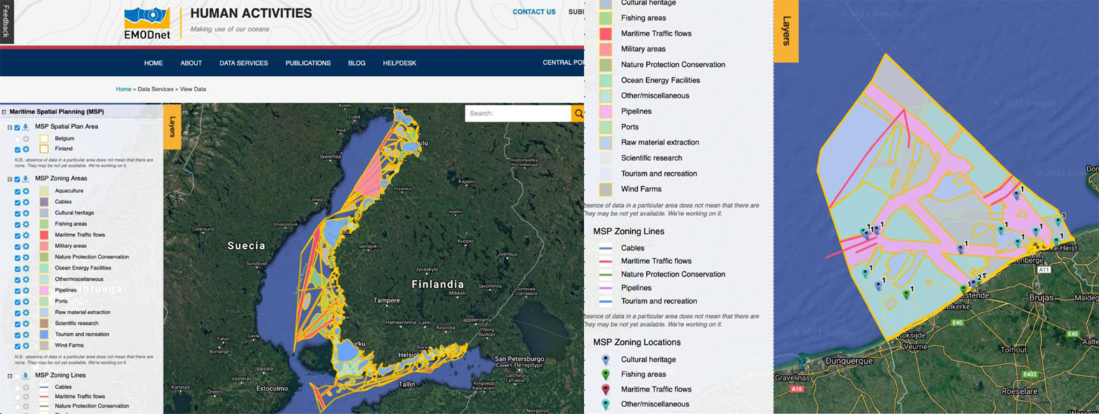
The data required for Maritime Spatial Plans are diverse and cross-sectorial, with varying data availability within the EU regions due to differences in applied data management, data infrastructure, specifications and documentation. Plans delivered by EU Member States which use different non-standardized database structures (so called data models) and which apply diverse labels, make it difficult to understand, compare and assess planning coherency in cross-border contexts, at the sea basin and broader EU level.
In order to address this challenge, the Technical Expert Group on Data for MSP presents three ready to use data models, including a newly developed hybrid model which allows for conversion between the previously developed two data models. The TEG recommends that all Member States make use any of the three ‘ready to use’ solutions, as they can be easily integrated in to the EMODnet Human Activities geoportal in order to display MSP plans at the local, sea basin and European level.
This report represents a technical solution for harmonizing the data of maritime spatial plans following INSPIRE Directive 2007/2/EC principles, in order to reach a common MSP layer for Europe which is vital in order to allow for informed, collaborative and sustainable planning of Europe’s seas in to the future.
Originally published by the European Maritime Spatial Planning Platform.